Building Better Bike Connections - Western Link, Geelong
The Building Better Bike Connections project is a $4.7 million project led by the City of Greater Geelong and funded by the TAC’s Safer Pedestrian and Cyclist Fund.
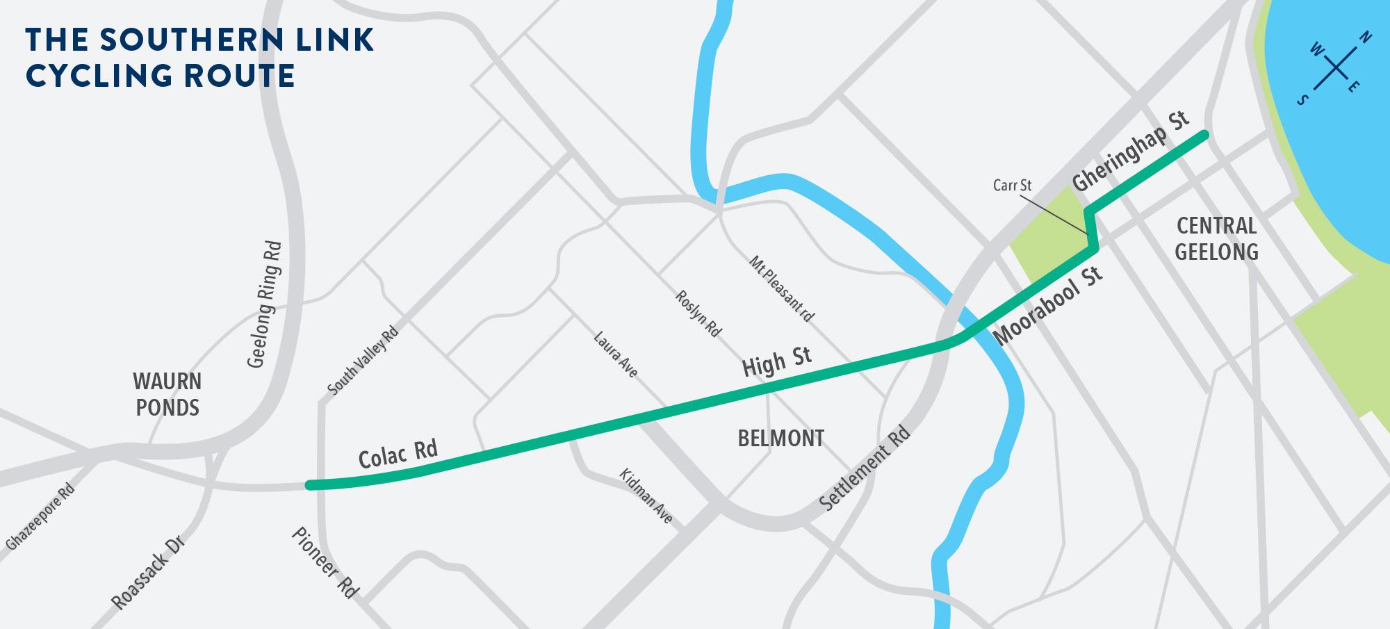
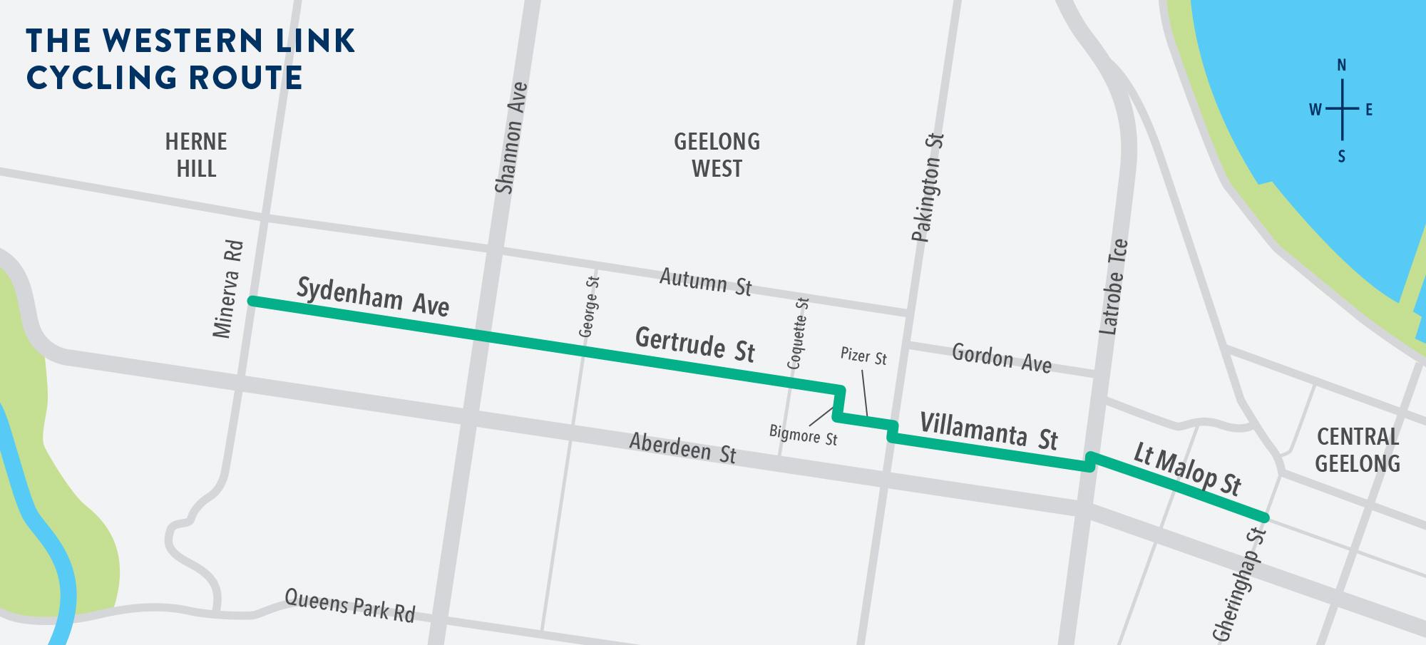
The Western Link, part of the Central Geelong to Herne Hill Strategic Cycling Corridor, was approved by the City of Greater Geelong in the 14 August 2018 Council Meeting, costing $1.325 million. The project links Little Malop Street at La Trobe Terrace to Minerva Road in Manifold Heights, just falling short of Herne Hill. The Strategic Cycling Corridor extends north up Minerva Street and west along Autumn Street to Herne Hill, which was not within the scope of this project.
The project uses various traffic calming measures and signage to reduce through traffic and speeds along this corridor and aims to encourage cycling as a means of transport for all ages and abilities.
A major failure of this project is keeping the default 50 km/hr speed limit – unsuitable for comfortable sharing between bicycles and other vehicles.
Background of bicycle streets
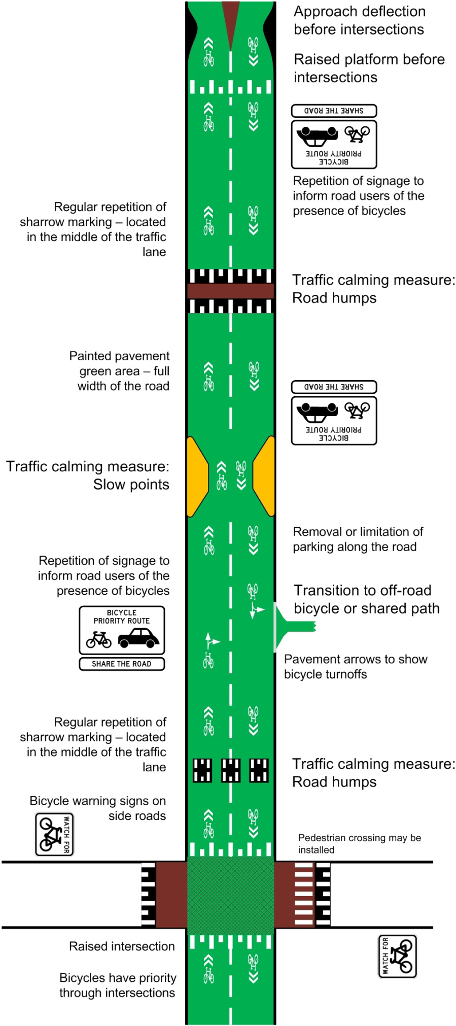
VicRoads has provided guidance on the design of Strategic Cycling Corridors in its Traffic Engineering Manual Volume 3 Part 218. Chapter 5.3.3 (a) on bicycle streets states:
Bicycle streets are roads where bicycles are given priority over motor vehicles. Bicycle riders are encouraged to ride in the general traffic lane whereby other vehicles are expected to share the traffic lane with bicycle riders.
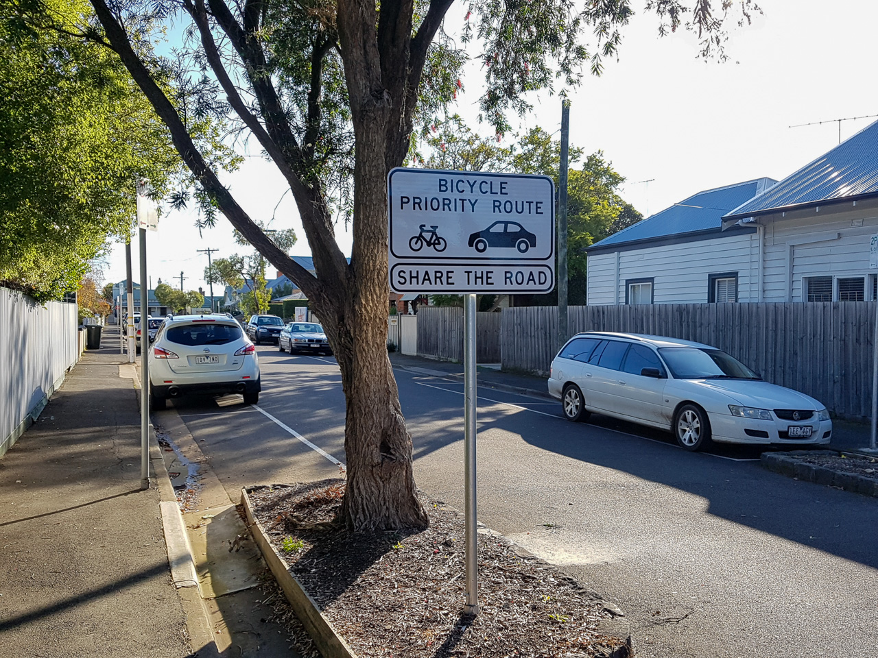
This project was guided by the TEM, with the non-standard bicycle priority route signage also adopted from here. Please see the VicRoads TEM for more details. This project creates one of the first two bicycle streets in Victoria, the other being Napier Street in Fitzroy.
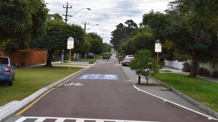
Western Australia piloted this design in its Bayswater to Morley Bike Boulevard project. The more intensive use of traffic calming and coloured treatment for the entire street make theirs a much lower speed environment than the Herne Hill route.
Explore the corridor
Sydenham Avenue, Manifold Heights
Starting at Minerva Road on the boundary of Newtown and Manifold Heights, we head towards the city on Sydenham Avenue.
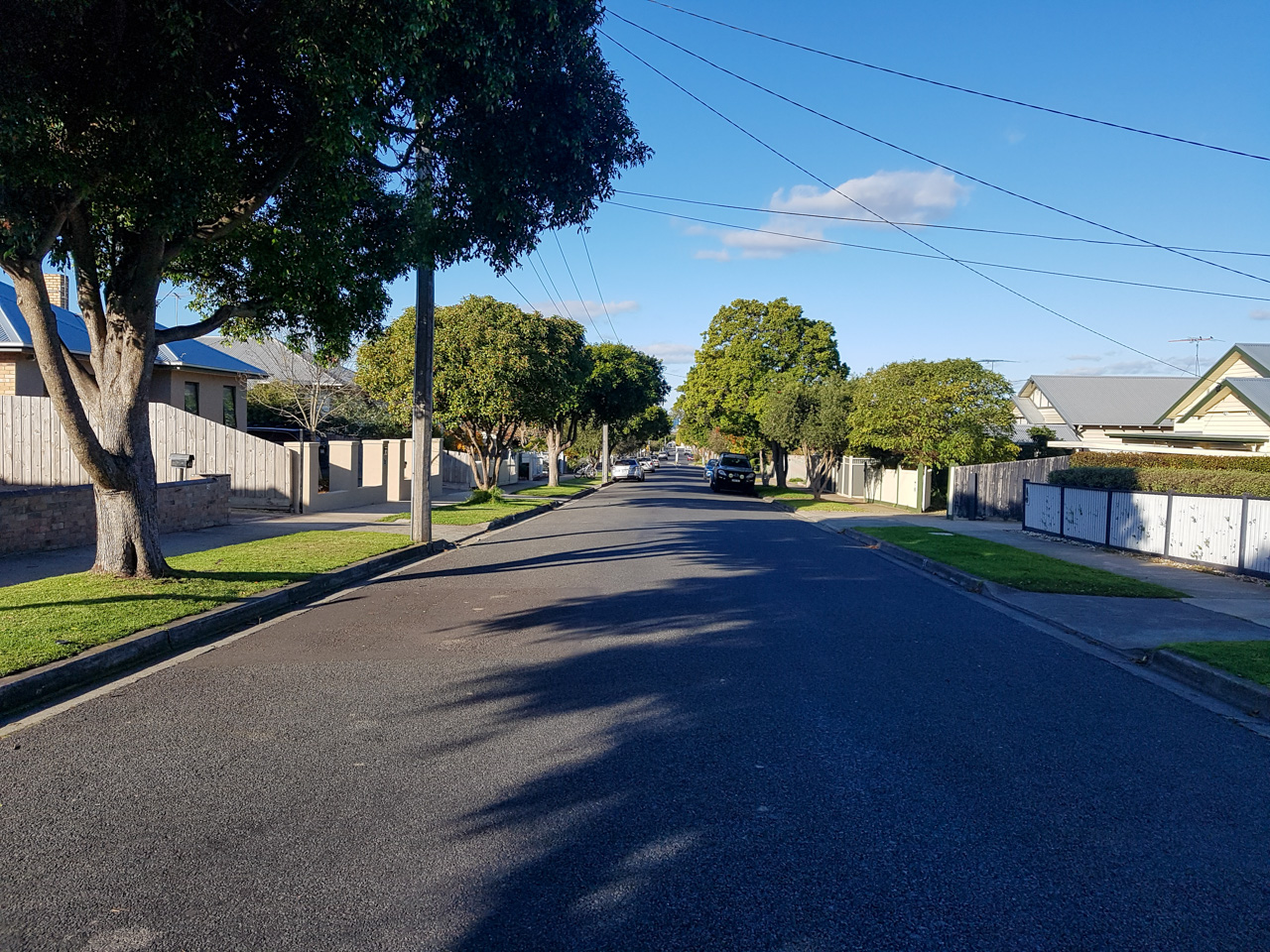
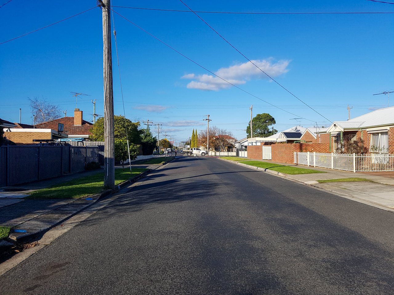
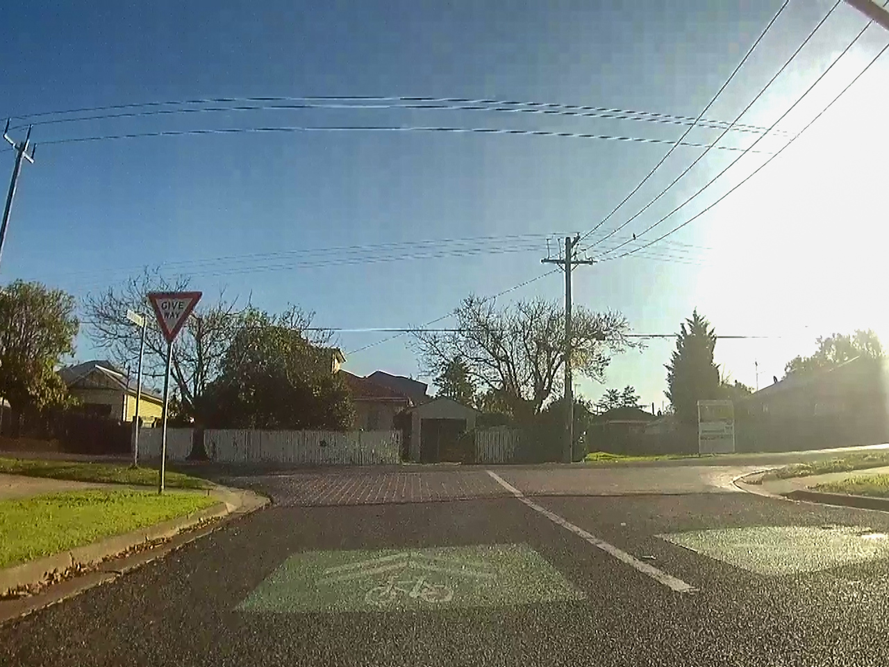
This section of the route has minimal improvements. At the two ends of Sydenham Avenue, sharrows on a green background were painted – this is the only indication that this is a bicycle route. There is little to distinguish this road from any other local road in the area.
Unlike other sections, no additional traffic calming measures were installed on Sydenham Avenue. Three existing modified T-intersections (deflection and traffic island), spaced 180 metres apart, were retained as traffic calming devices on Sydenham Avenue. These may be ‘pinch-points’ for bicycles and use of sharrows to discourage overtaking here may be warranted.
Intersection of Sydenham Avenue, Shannon Avenue and Gertrude Street
From Sydenham Avenue, newly constructed pedestrian operated signals with bicycle lanterns enable the safe crossing of Shannon Avenue, an arterial road.
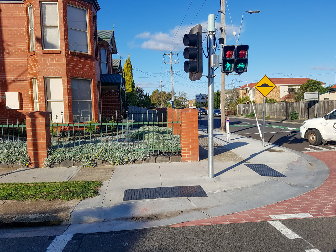
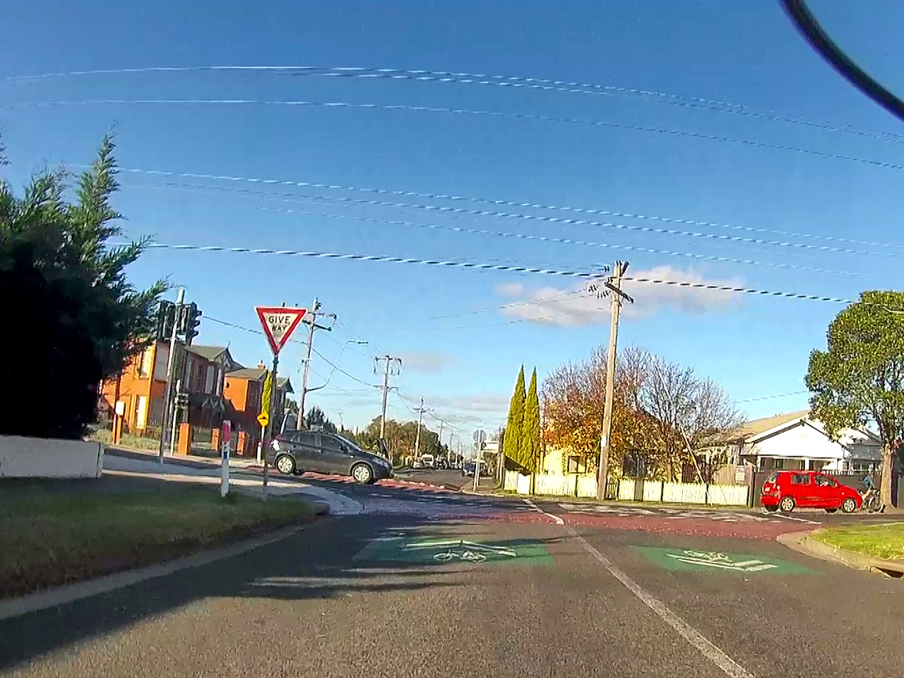
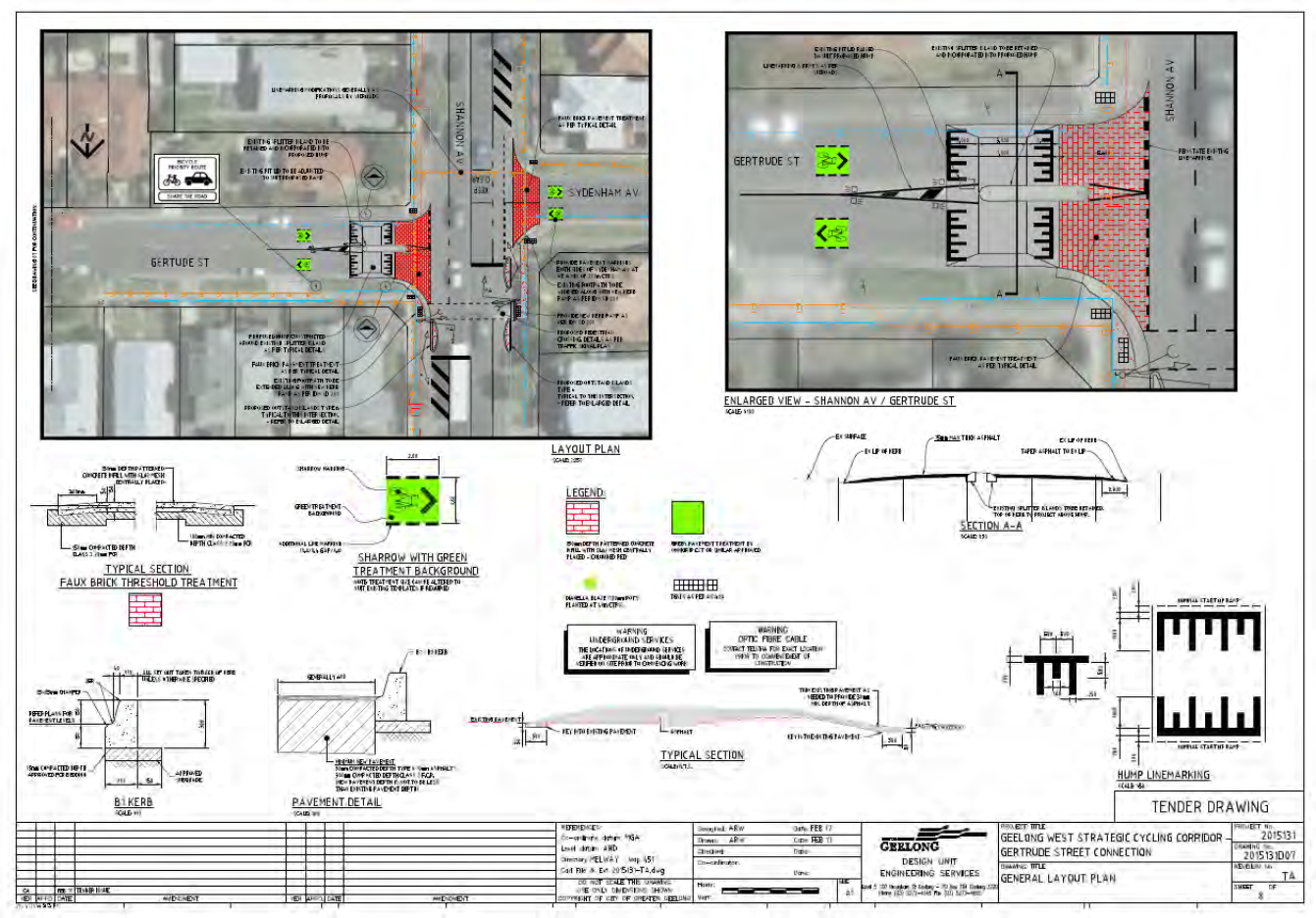
Unfortunately, no priority is given to bicycle movements when transitioning from the path to the road. The path is also unsigned and unmarked, therefore not designated as a shared path and currently technically illegal to cycle on. The transition is somewhat inconvenient, and some may choose the undertake the riskier maneuver of crossing Shannon Avenue directly.
Gertrude, Bigmore, and Pizer streets, Geelong West
This section of the route includes new slow-points, flat-top speed humps, bicycle priority route signs, and sharrows. This creates a much lower speed environment than Sydenham Avenue.
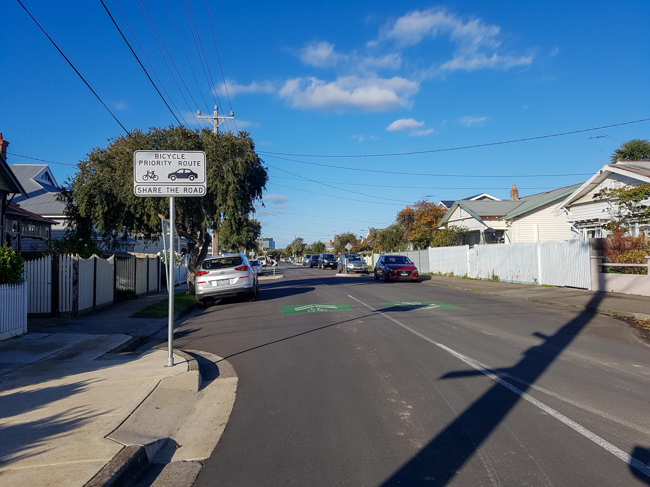
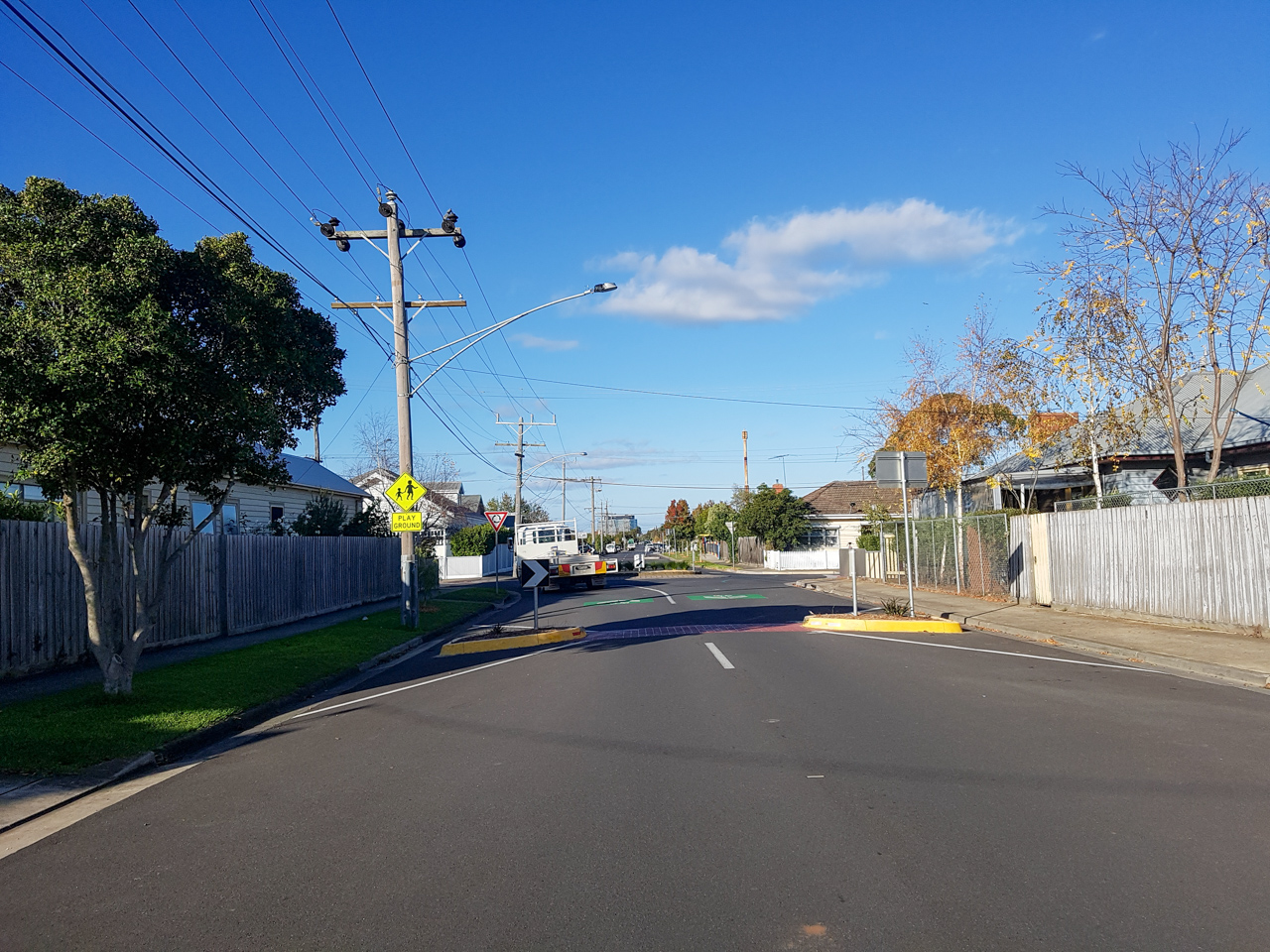
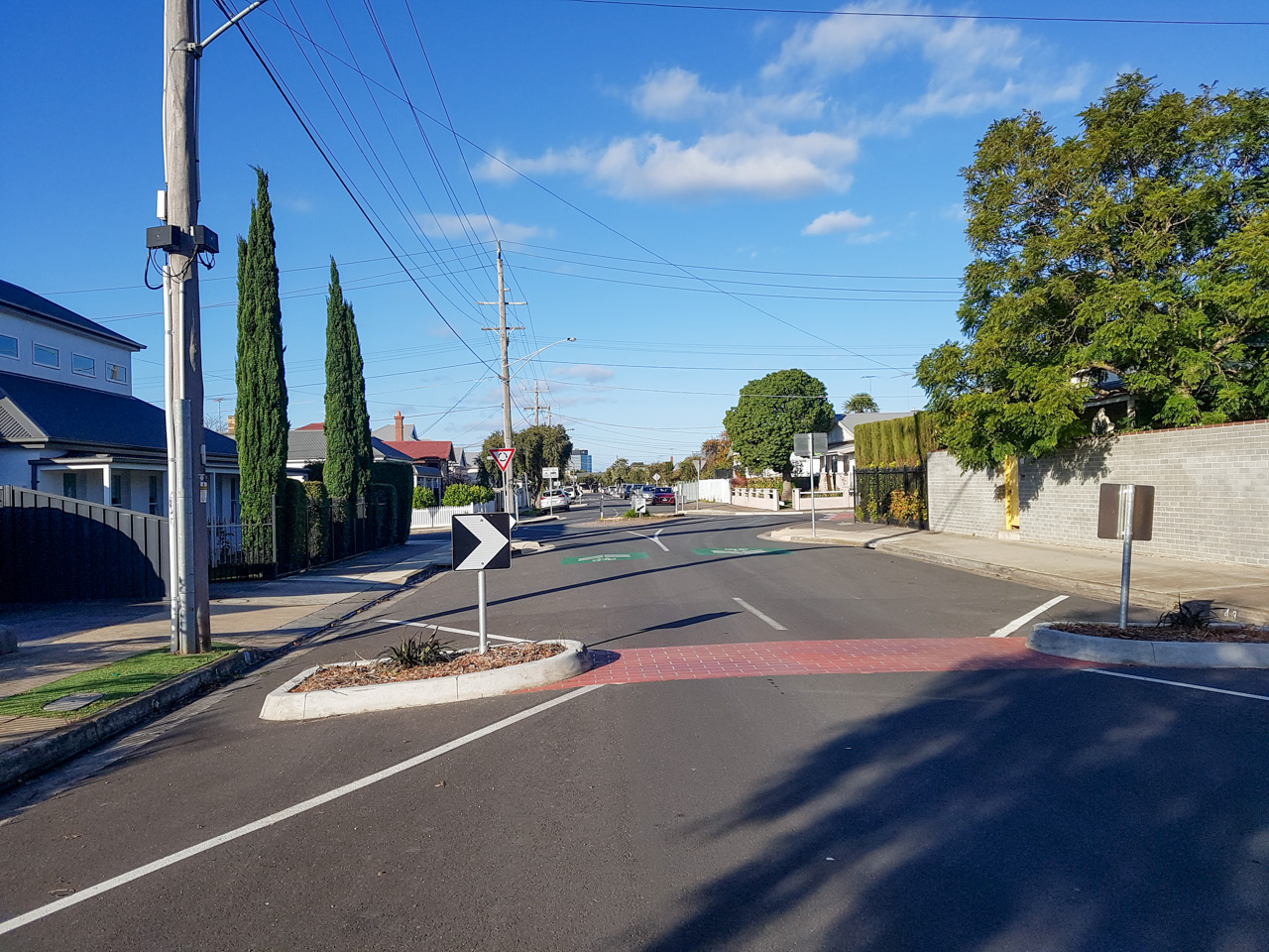
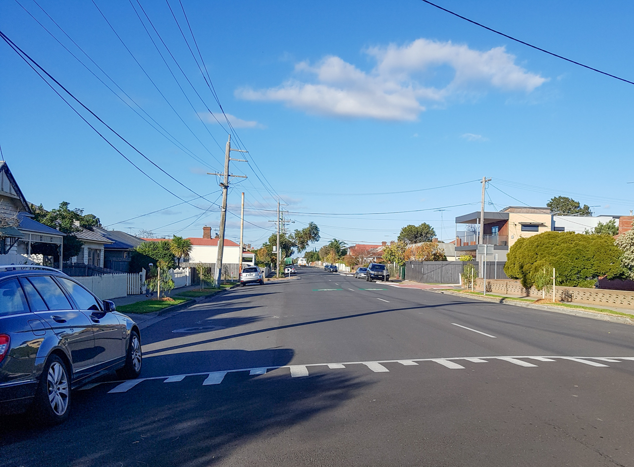
Interestingly, green guidance lines were used to guide cyclists through potential pinch points like roundabouts and a larger intersection.
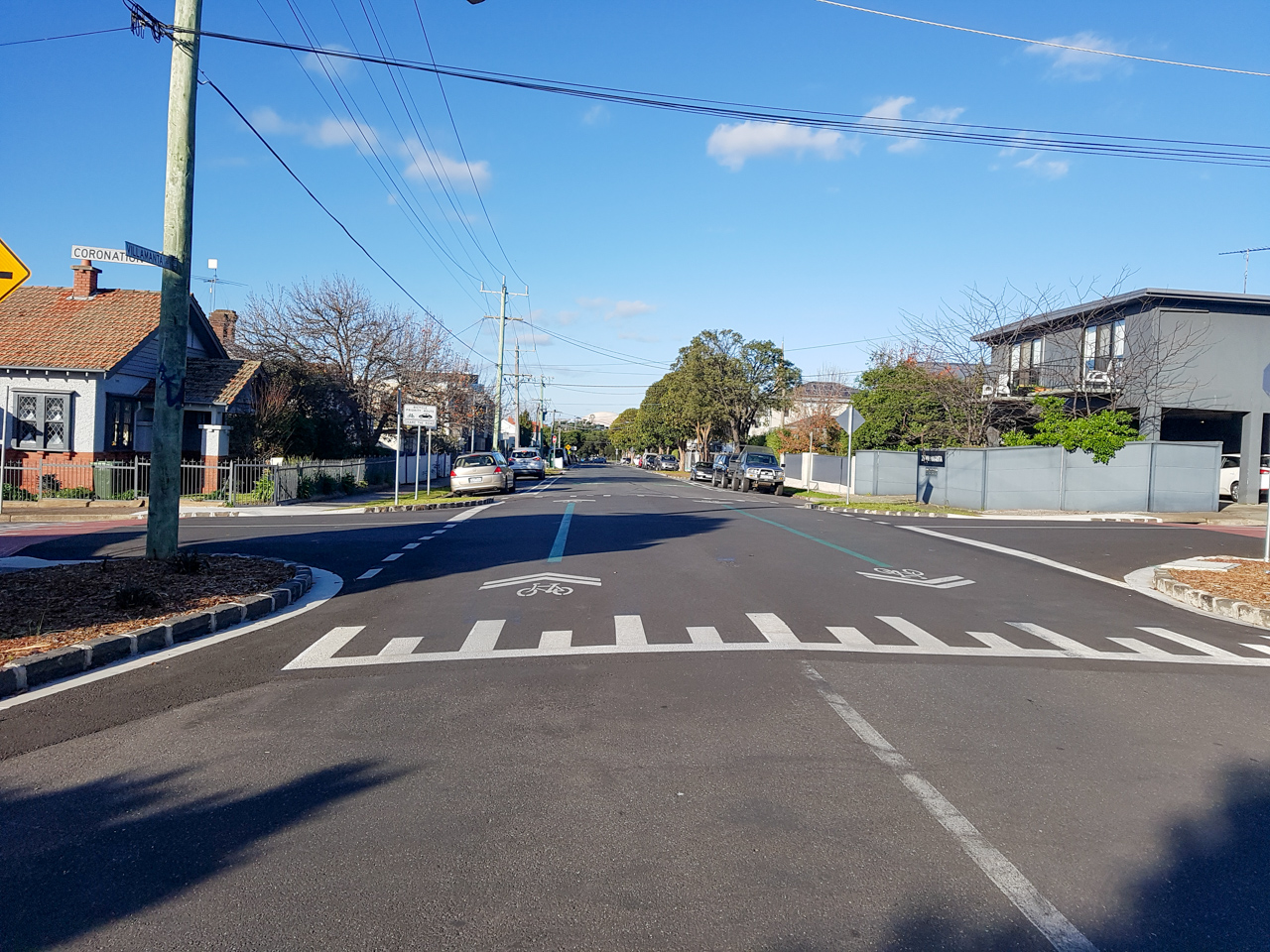
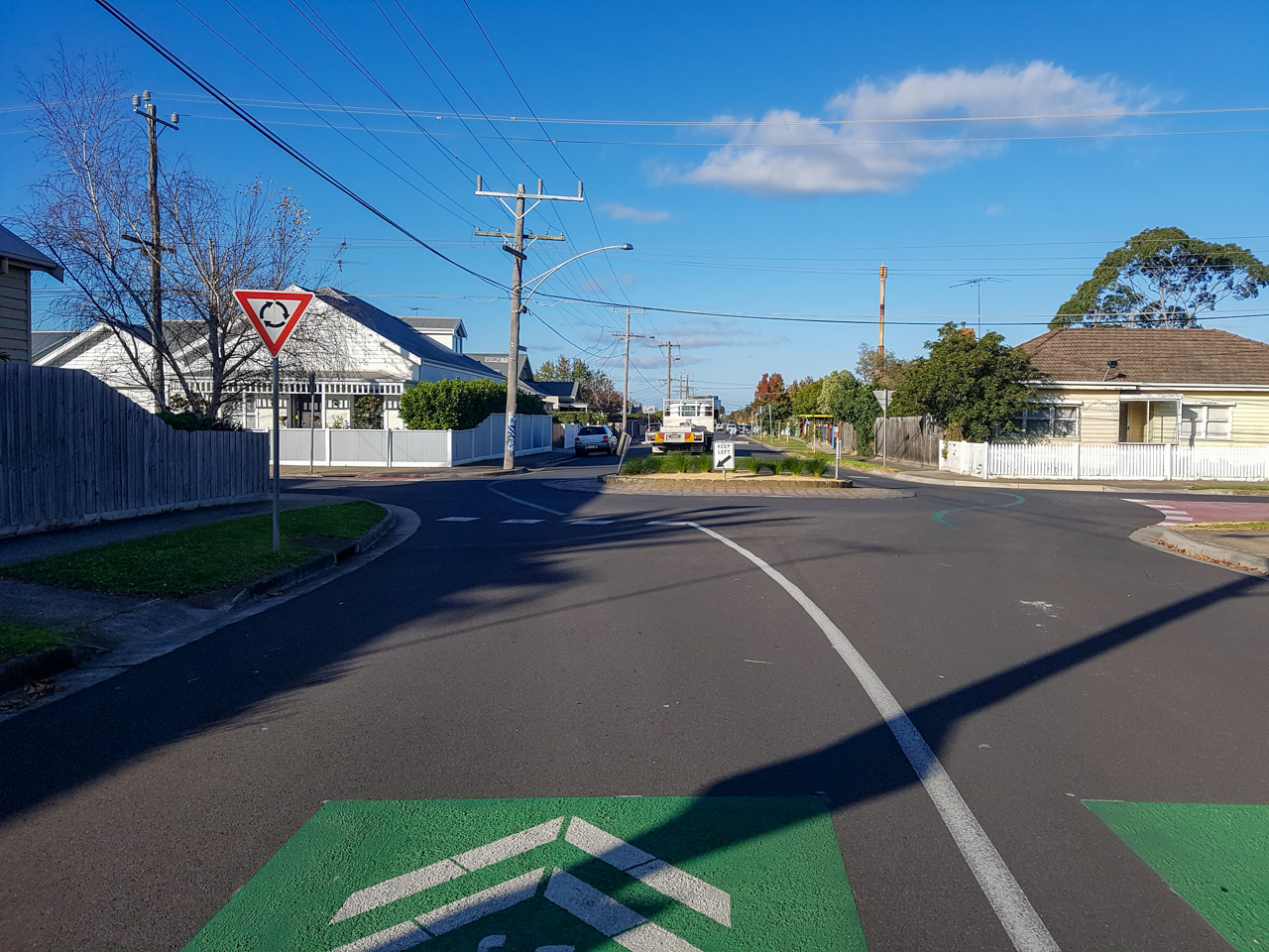
Kerb extensions have also been constructed at most side streets, reducing the turn radius and vehicle speeds. Perhaps with a larger budget, more streetscape improvements such as realigning the kerb to narrow some very wide mid-block sections could be undertaken.
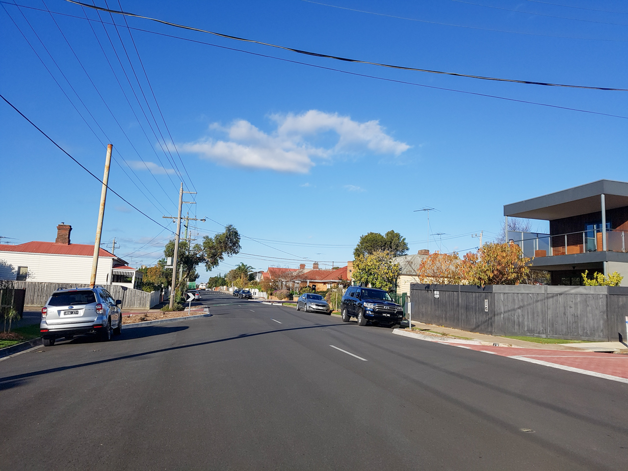
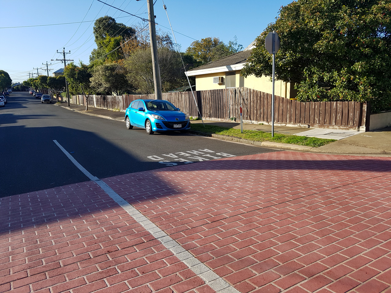
All side roads on this route from Gertrude Street towards the CBD all have coloured entry statements and ‘Bikes Ahead’ markings to warn vehicles that they’re entering a low-speed environment. It’s important to ensure drivers can distinguish this route as being different to other roads and to expect higher bicycle volumes.
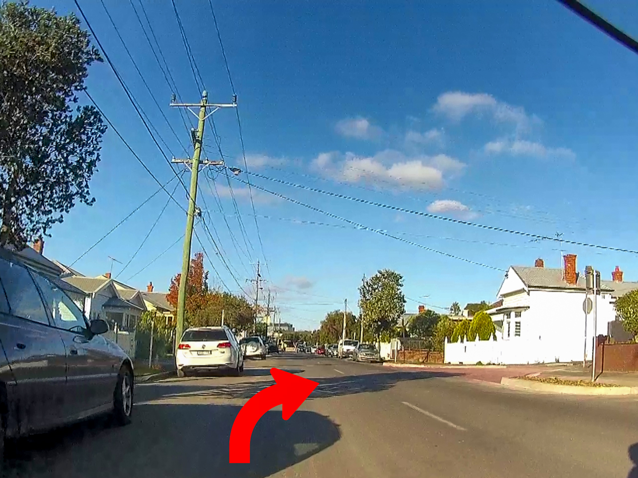
At the eastern end of Gertrude Street, to continue along the corridor, cyclists must turn right into Bigmore Street, then turn left into Pizer Street. This is not signposted or marked anywhere and will be missed by those unfamiliar with the route (myself included) – a potential point of improvement.
Villamanta Street, Geelong West
Villamanta Street mid-block, like on Gertrude Street, has additional traffic calming devices. These include a flat top speed hump/table (replacing a roundabout), sharrows, kerb extensions and entry statements on all side streets.
This section also has a painted buffer zone to discourage users from cycling in the ‘door-zone’.
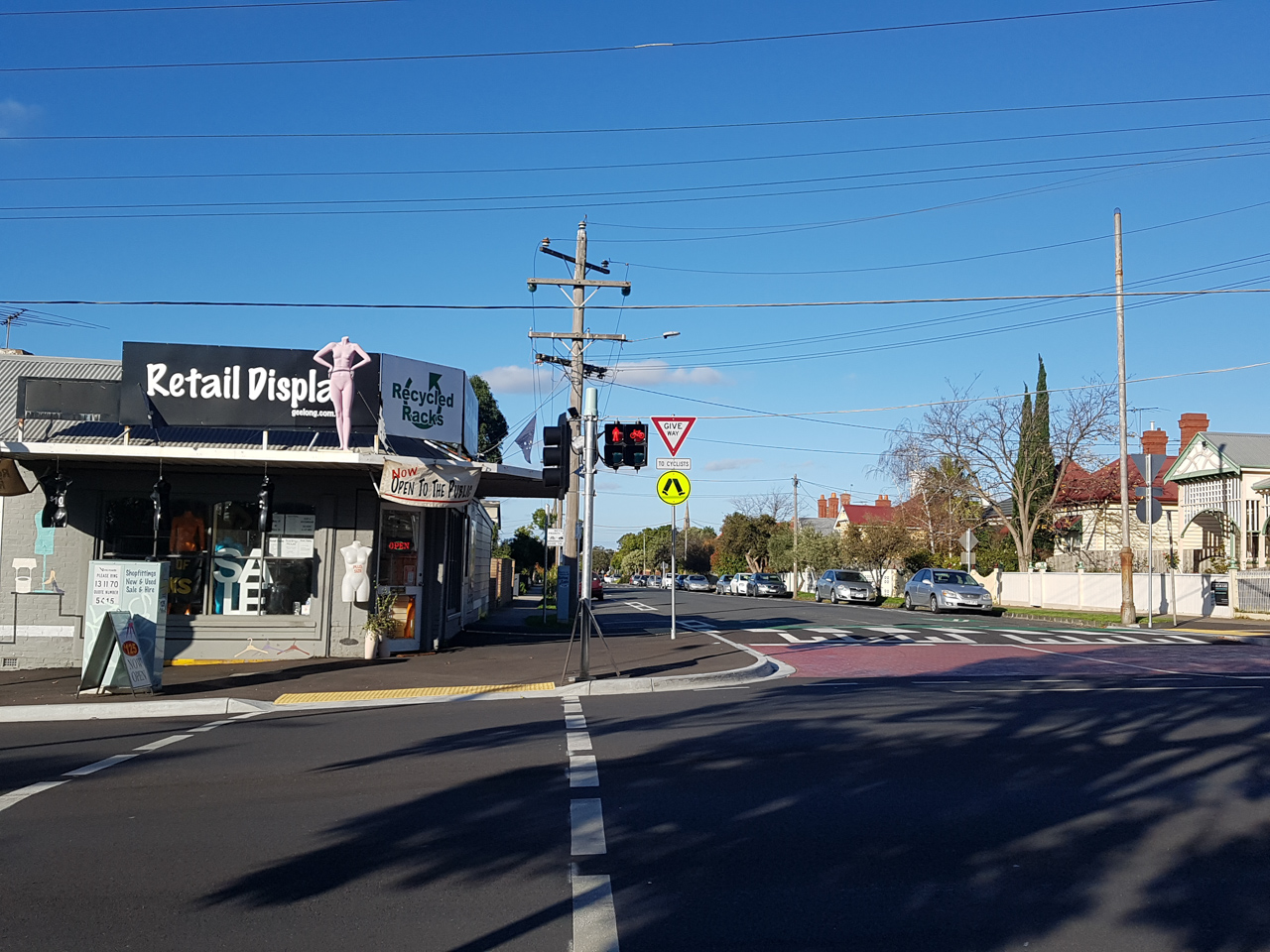
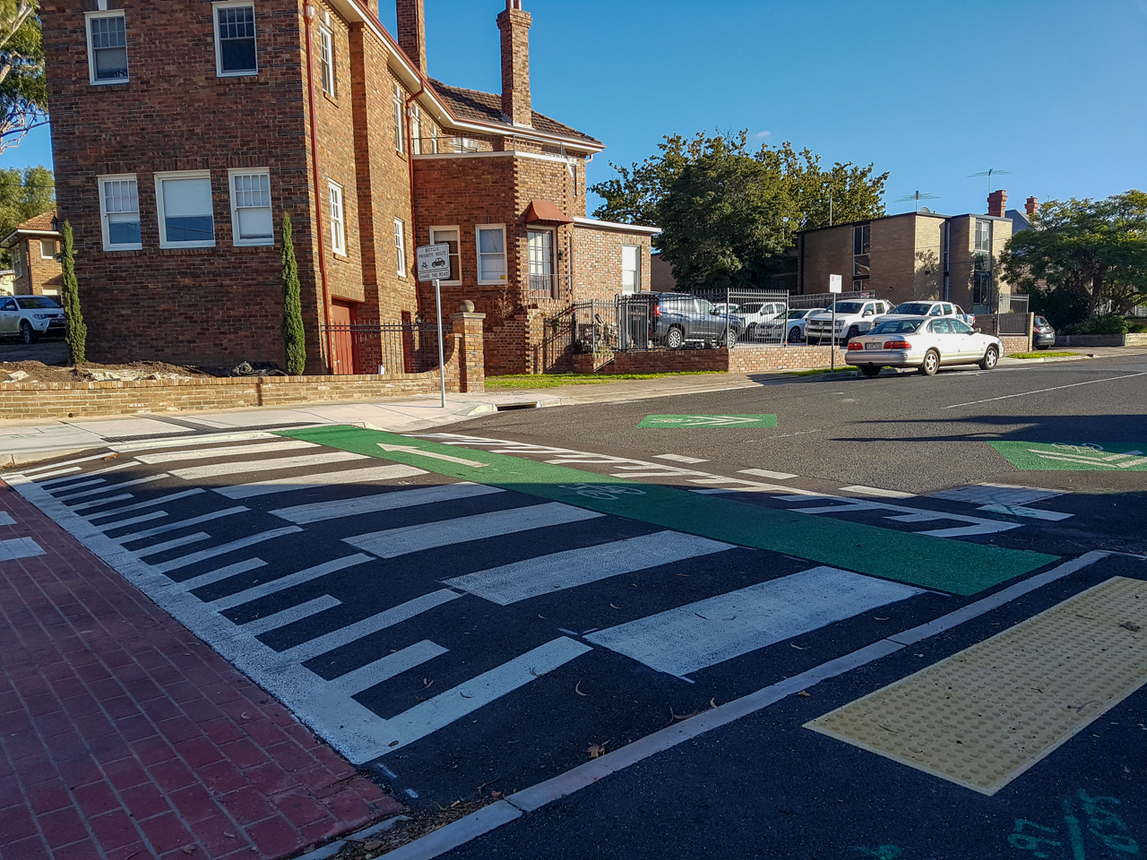
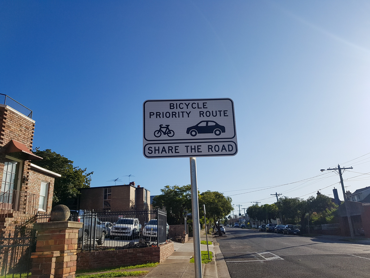
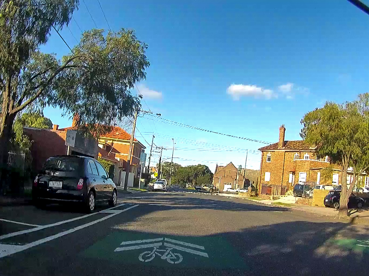
The two ends of Villamanta Street have raised separated path crossings where bicycles and pedestrians have priority. This ensures safe and convenient transitions from the road to the path and is an excellent addition to the corridor. Also note that like previously, no shared path signage is present and it remains technically illegal to cycle on these paths.
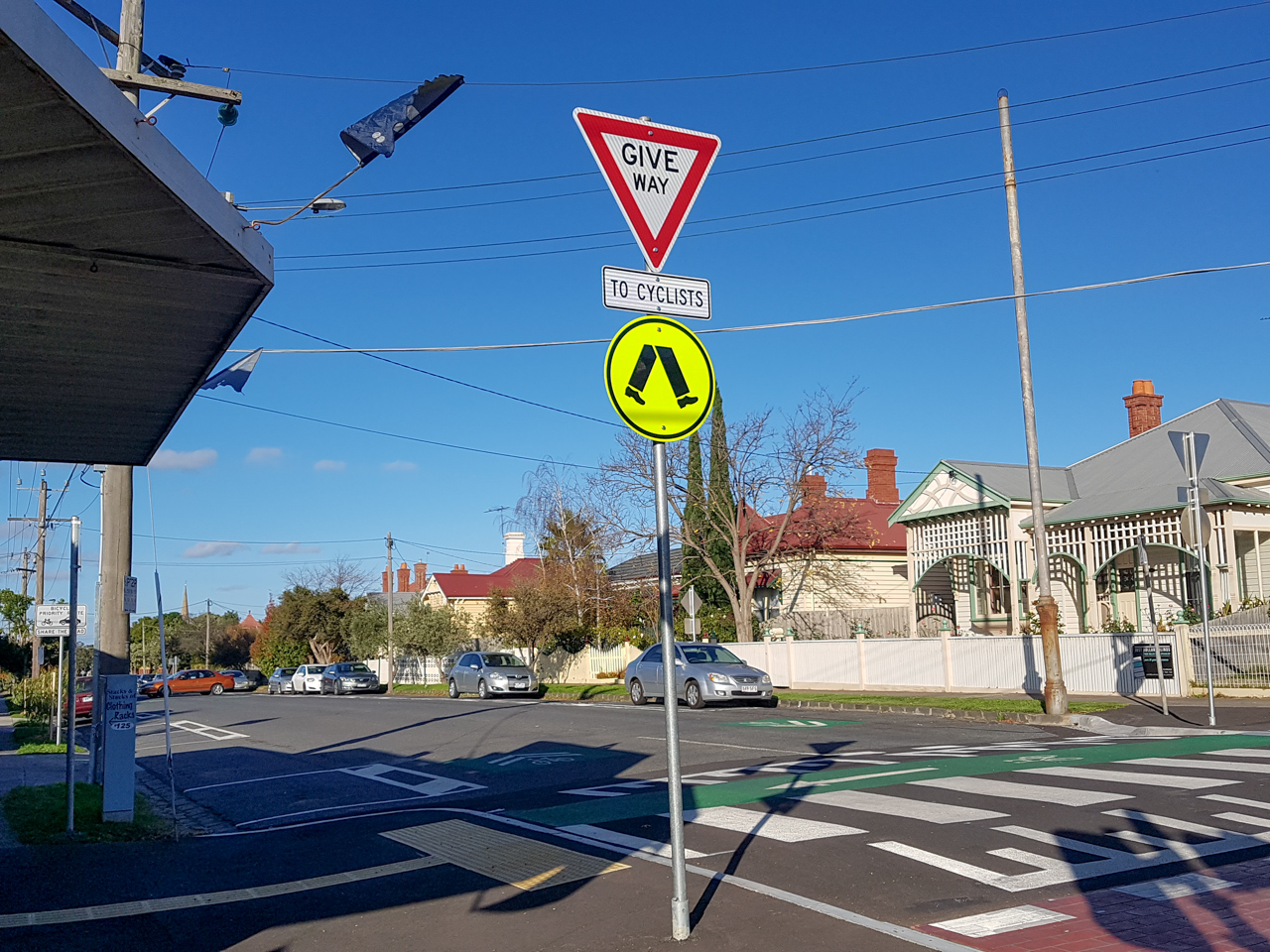
Crossing to Little Malop Street, Geelong
The crossing of busy La Trobe Terrace uses existing pedestrian operated signals, with widened kerb ramps. However, this project did not add bicycle aspects, with only pedestrian lights displayed. This makes it illegal for cyclists to cross without dismounting. A missed opportunity as these signals were reconfigured as part of this project.
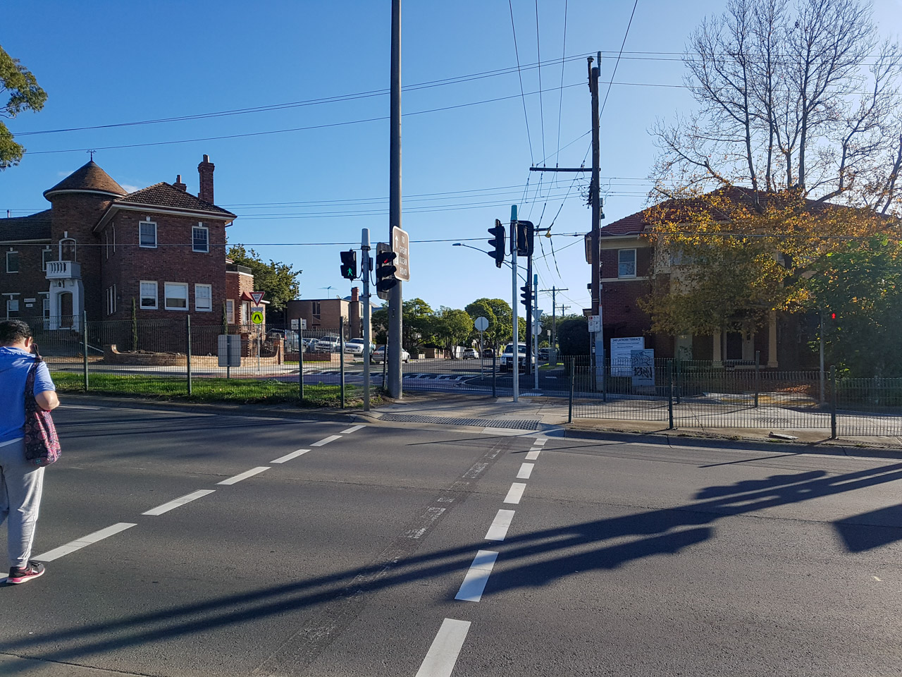
This connects the corridor to the existing Little Malop Street, which features a separated bicycle path.
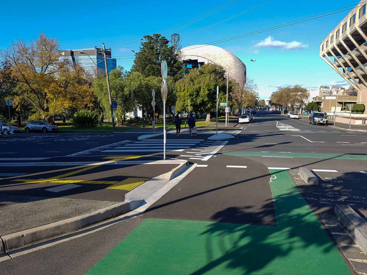
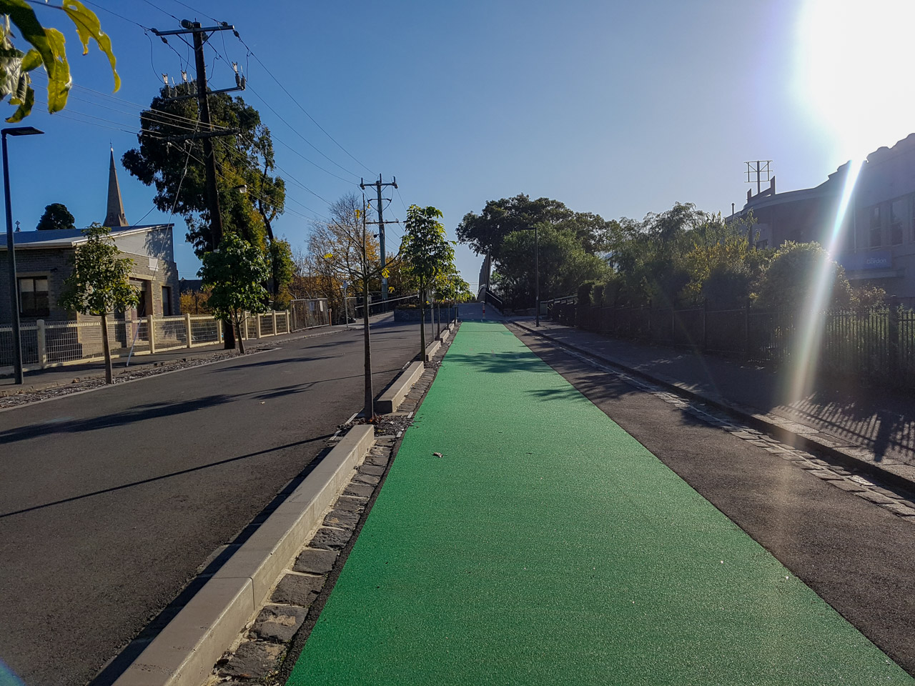
Note that in early 2020 a raised pedestrian ‘wombat’ crossing was constructed as pictured at Fenwick Street. Currently, the path spits cyclists out at the intersection, a confusing and uncomfortable situation for cyclists. Extension of the raised pedestrian crossing to include the bicycle path should have been considered, another missed opportunity.
There is also little safe infrastructure beyond this point. The Malop Street Green Spine, Johnstone Park upgrades, and Better Bike Connections Southern Link along Gheringhap Street have all stalled – without a complete corridor into the CBD, the less confident will not consider cycling to be a safe way to get to the city.
Further reading
- See the engineering drawings for the Western Link in the 14 August 2018 Council Meeting documents. Note that revisions have been made and may not accurately reflect what was constructed.
- CoGG’s Building Better Bike Connections project webpage. Much of the content has been removed, progress on the politically sensitive Southern Link seems to have stalled.
- Read VicRoad’s Traffic Engineering Manual Volume 3 Part 218, Design Guidance for strategically important cycling corridors. Chapter 5.3.3 (a) discusses bicycle streets.

Leave a comment
Your email address will not be published. Required fields are marked *